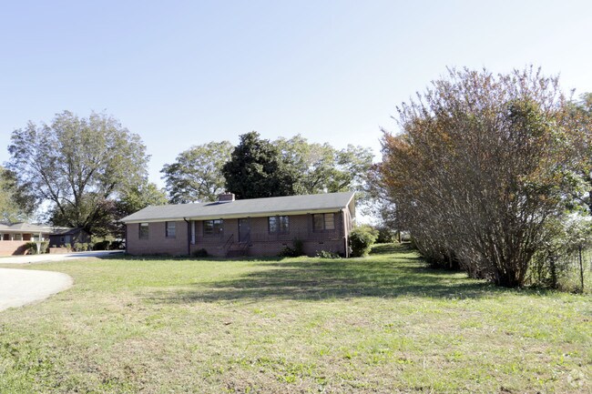
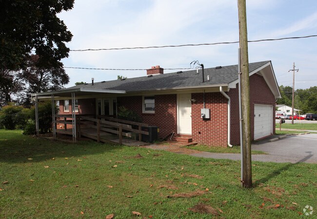
Property Record
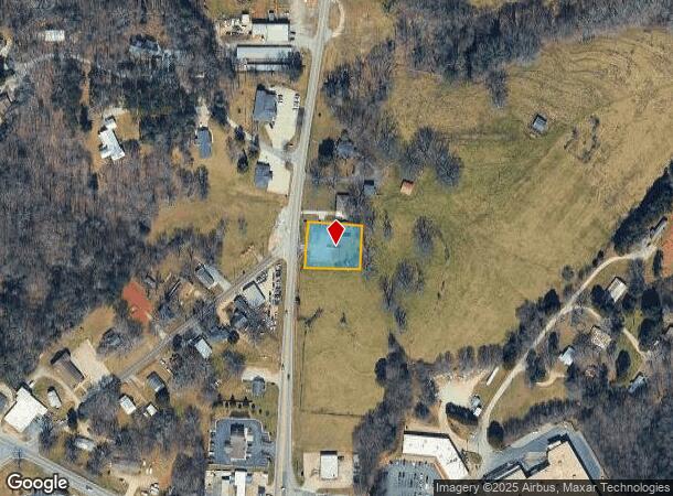
790 Us Highway 441 Hwy, Demorest, GA 30535

NEARBY LISTINGS FOR SALE OR LEASE
Property Detail
790 Us Highway 441 Hwy
081-031
10-80 81 PB 57-205 1301-38
Medicalbuilding
Habersham
X
Georgia
13137C0216D
0.43 AC
2025
Georgia Northeast
2025
Other Market Areas
000502
Cornelia, GA
2,239 SF
DEMOGRAPHICS near 790 Us Highway 441 Hwy
1 Mile
3 Mile
5 Mile
2024 Total Population
1,508
13,034
28,971
2029 Population
1,649
14,329
31,854
Pop Growth 2024-2029
+ 9.35%
+ 9.94%
+ 9.95%
Average Age
37
38
39
2024 Total Households
533
4,667
10,432
HH Growth 2024-2029
+ 9.76%
+ 9.77%
+ 9.68%
Median Household Inc
$62,386
$54,704
$56,542
Avg Household Size
2.30
2.60
2.60
2024 Avg HH Vehicles
2.00
2.00
2.00
Median Home Value
$210,784
$165,345
$173,079
Median Year Built
1993
1986
1989
Nearby Places
Map Layers
Map Styles
 Street
 Aerial
- Restaurants
- Banks
- Shops
- Fitness
- Groceries
Nearby Properties
Address
Land Use
TOTAL SIZE
Lot Size
Zoning
Address
Land Use
TOTAL SIZE
Lot Size
Zoning
200,600 SF
46.46 AC
LI
Address
Land Use
TOTAL SIZE
Lot Size
Zoning
216,507 SF
159.83 AC
MI
Address
Land Use
TOTAL SIZE
Lot Size
Zoning
253,404 SF
22 AC
HI
Address
Land Use
TOTAL SIZE
Lot Size
Zoning
97,985 SF
30 AC
LI
Address
Land Use
TOTAL SIZE
Lot Size
Zoning
97,144 SF
18 AC
R1A
Address
Land Use
TOTAL SIZE
Lot Size
Zoning
88,728 SF
37.73 AC
LI
Address
Land Use
TOTAL SIZE
Lot Size
Zoning
195,516 SF
19.95 AC
B2
Address
Land Use
TOTAL SIZE
Lot Size
Zoning
153,996 SF
24.72 AC
HI
Address
Land Use
TOTAL SIZE
Lot Size
Zoning
75,612 SF
29.13 AC
LI
Address
Land Use
TOTAL SIZE
Lot Size
Zoning
144,690 SF
7.51 AC
HI
Address
Land Use
TOTAL SIZE
Lot Size
Zoning
266,882 SF
152.11 AC
I
Address
Land Use
TOTAL SIZE
Lot Size
Zoning
57,800 SF
2.58 AC
SFR
Address
Land Use
TOTAL SIZE
Lot Size
Zoning
77,729 SF
69.23 AC
I
Address
Land Use
TOTAL SIZE
Lot Size
Zoning
55,608 SF
27.85 AC
I
Address
Land Use
TOTAL SIZE
Lot Size
Zoning
137,005 SF
20.74 AC
HI
Address
Land Use
TOTAL SIZE
Lot Size
Zoning
131,703 SF
15.25 AC
B1
Address
Land Use
TOTAL SIZE
Lot Size
Zoning
210,142 SF
27.50 AC
HI
Address
Land Use
TOTAL SIZE
Lot Size
Zoning
175,337 SF
10.63 AC
I
Address
Land Use
TOTAL SIZE
Lot Size
Zoning
75,762 SF
9.98 AC
R2
Address
Land Use
TOTAL SIZE
Lot Size
Zoning
27,492 SF
25.58 AC
LI
Address
Land Use
TOTAL SIZE
Lot Size
Zoning
53,453 SF
27.79 AC
R1
Address
Land Use
TOTAL SIZE
Lot Size
Zoning
21,168 SF
5.32 AC
HI
Address
Land Use
TOTAL SIZE
Lot Size
Zoning
76,344 SF
38.40 AC
HI
Address
Land Use
TOTAL SIZE
Lot Size
Zoning
47,520 SF
2.02 AC
HI
Address
Land Use
TOTAL SIZE
Lot Size
Zoning
30,632 SF
16.42 AC
LI
Address
Land Use
TOTAL SIZE
Lot Size
Zoning
58,572 SF
5.83 AC
B2
Address
Land Use
TOTAL SIZE
Lot Size
Zoning
35,720 SF
7.75 AC
HI
Address
Land Use
TOTAL SIZE
Lot Size
Zoning
87,830 SF
9.48 AC
B1
Address
Land Use
TOTAL SIZE
Lot Size
Zoning
32,210 SF
25.25 AC
HI
Address
Land Use
TOTAL SIZE
Lot Size
Zoning
66,994 SF
8 AC
I
The World's #1 Commercial Real Estate Marketplace
Connect with us
© 2025 CoStar Group
The information above has been obtained from sources believed reliable. While we do not doubt its accuracy we have not verified it and make no guarantee, warranty or representation about it. It is your responsibility to independently confirm its accuracy and completeness. Any projections, opinions, assumptions, or estimates used are for example only and do not represent the current or future performance of the property. The value of this transaction to you depends on tax and other factors which should be evaluated by your tax, financial, and legal advisors. You and your advisors should conduct a careful, independent investigation of the property to determine to your satisfaction the suitability of the property for your needs.